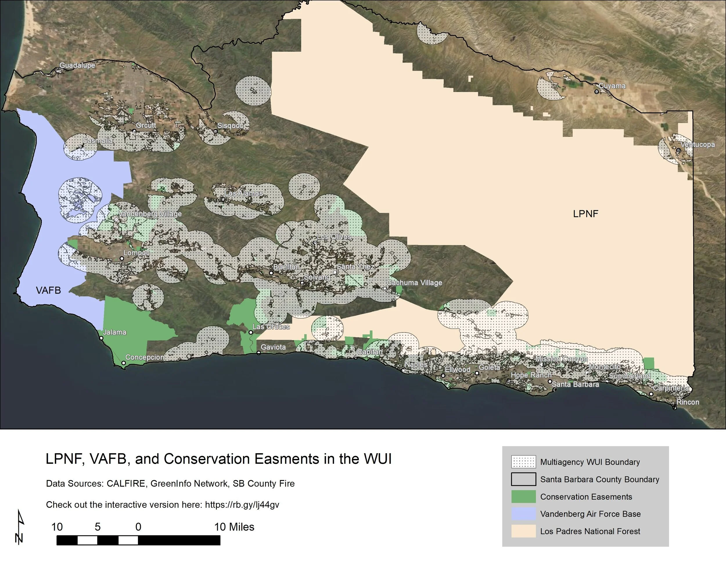
Coordination of WUI Projects Across Management Entity Boundaries for example with LPNF, VAFB, Land Trusts, and County Parks

When fires occur, they often start in areas of the national forest and enter into the unincorporated WUI portions of the County. There is a need to conduct detailed mapping of invasive, flammable vegetation or other fire risks in key WUI interface areas and high risk areas of the Los Padres National Forest, Vandenberg Space Base (formerly AFB), Land Trust holdings, and nature preserves. Projects that have already been identified in existing permit-approved planning documents for federally-managed lands should be implemented. Some of these areas include various regions of the backcountry that directly interface with rural communities in the unincorporated portions of the County, which often include lower income and vulnerable populations (such as Painted Cave, Paradise, etc, and adjacent to VSB, Jalama County Beach Park, and neighboring ranches and Preserves/Land Trust properties) who are at very high risk of catastrophic fire. Once the mapping is completed, the projects that have been identified should be prioritized for implementation depending on the level of risk.
Status: Conceptual
Cost: Medium
Partners:
Permitting: Site-specific CEQA may be required if not already addressed as part of existing fire management plans or the California VTP that have undergone CEQA or National Environmental Policy Act (NEPA) review. This will be determined once project boundaries and details are specified. Projects located in unincorporated Santa Barbara County that would cross into Federally managed areas may require joint NEPA/CEQA documentation. Work completed in the coastal zone may require a Coastal Development Permit.
Funding Sources:
Additional Notes: Requires significant capacity for facilitation, project management and coordination. Fire risk management in State Parks properties is considered high priority and actionable. Parks properties can play a critical role in wildfire mitigation in addition to preservation. This should be coordinated with Brook Sheridan, the County FD contact for state parks out of the Ventura Office.
Projects in the LPNF are important but difficult if not impossible to activate at this time. Approved projects have languished in the Los Padres due to staffing capacity issues and funding challenges, as well as potential legal challenges.
County Parks is another willing partner and would need both staffing and funding to undertake more deliberate fire risk reduction projects in their park planning documents.
Land Trusts (Land Trust for Santa Barbara County, California Rangeland Trust, Trust for Public Land, etc.) are important potential partners in this effort, and coordination with them to incorporate fire management both in their consideration of new acquisitions and management of existing easements should be considered.
(Click on the image to expand this static map.)